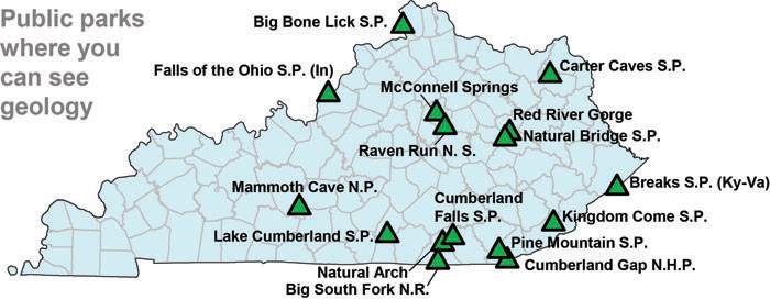
Public Parks in Kentucky Where You Can See Geology
Big Bone Lick State Park

Fossils of ice-age mammals from this site provided some of the first evidence for extinction. Fossils were studied by Georges Cuvier, Benjamin Franklin, and Thomas Jefferson, among others. Specimens from Big Bone Lick are in collections at some of the world’s most famous natural history museums. The park has a small museum with ice-age fossil remains of mammoths, mastodons, bison, and other creatures that lived in the area, as well as a short film on the natural history of the region. Visitors can walk around a recreated scene from the ice age outside of the interpretive center.
Blue Licks Battlefield State Resort Park
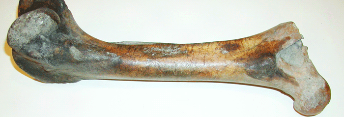
Although the park’s main focus is the Revolutionary War battle that occurred here, it’s pioneer museum includes displays on the natural history of the salt licks that drew animals and humans to this site. Ice-age fossil remains of mammoths, mastodons, musk ox, bison, and other creatures that lived in the area, as well as local Ordovician fossils, are also on display.
Carter Caves State Resort Park
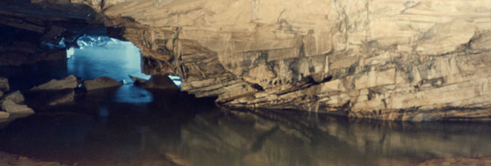
Several small caves are on the park property and are part of Bat Cave and Cascade Caverns State Nature Preserves. The nature center provides information about caves, and multiple cave tours are offered daily. Scenic trails in the park pass rock outcroppings along Tygarts Creek, and several small natural arches. Pennsylvanian-age sandstones and Mississippian-age sandstones and limestones are well exposed along several trails.
Cumberland Gap National Historic Park
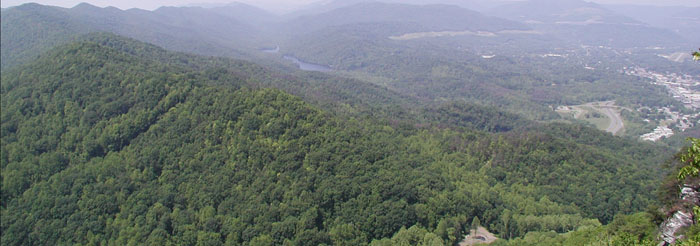
Cumberland Gap is a natural break in the Appalachian Mountains, which was the gateway west for early pioneers and settlers in the region. The gap was created by weathering and erosion along the Rocky Face Fault. The park is located on the Pine Mountain Thrust Block. A nature center at the park has information about regional geology. Scenic trails offer overlooks of Middlesboro, as well as rocky cliffs and small waterfalls. From the gap, the circular shape of the Middlesboro Basin can be seen. This basin was formed through erosion of broken rock strata that once lay beneath an ancient meteor impact site. Tours of Gap Cave are also offered at different times of the year in the Virginia portion of the park.
- https://www.nps.gov/cuga/index.htm
- Did you know that Pine Mountain has moved?
- McGrain’s (1985) Geologic Story of Kentucky
- Guidebook Series: Geologic Impacts on the History and Development of Middlesboro, Kentucky.
- Crawford and Hunsberger’s (2011) Geology of Cumberland Gap National Historic Park poster
Kingdom Come State Park

The park straddles the crest of Pine Mountain at an elevation of 2,700 ft above sea level. Pine Mountain is a part of the earth's crust which has been thrust up and over another block of the earth's crust. Scenic trails provide overlooks of the valleys more than 1,000 ft below, and are lined by Pennsylvanian-age conglomeratic sandstones.
Mammoth Cave National Park
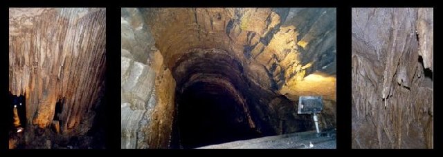
Mammoth Cave is the world’s largest cave, with nearly 390 miles of passages. It is twice as long as the second-longest cave. Mammoth Cave is a National Park, a World Heritage Site, and a Biosphere Reserve. The park offers many different types of cave tours. The nature center has exhibits and information about caves and the history of the park. Scenic walking trails are also available to examine the karst landscape on the surface, above and around the cave.
Natural Arch Scenic Area, Daniel Boone National Forest

Natural Arch, locally referred to as McCreary Arch, is a large natural arch. It is the second-longest arch in the state. The arch is approximately 1 mile from the parking lot and is accessible by trail. Outcrops of Pennsylvanian-age conglomeratic sandstones are well exposed along the trail.
Pine Mountain State Resort Park

Pine Mountain is a part of the earth’s crust which has been thrust up and over another block of the earth’s crust. At the park, the block has moved approximately 10 miles from its original position. Beds tilted by movement along the thrust fault can be observed along U.S.25E beneath the park in Pineville. Scenic trails are lined by rocky cliffs of Pennsylvanian-age conglomeratic sandstones.
Red River Gorge, Daniel Boone National Forest

The gorge is a National Natural Landmark, a dedicated Geological Area, and part of Daniel Boone National Forest.The Gladie Cultural-Environmental Learning Center has exhibits and information about local geology and natural history. The gorge area contains many natural arches, rock shelters, cliff lines, and waterfalls, mostly developed in Pennsylvanian-age conglomeratic sandstones. Some of the most visited locations are Nada Tunnel, Chimney Rock, Tower Rock, and Sky Bridge.
Big South Fork National River and Recreation Area
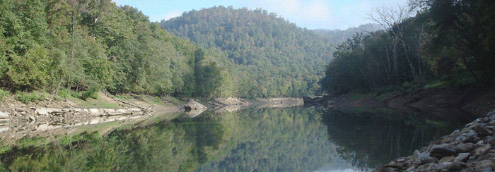
The historical coal-mining community of Blue Heron is preserved in the Kentucky side of the park. Blue Heron can be accessed by car or you can ride in a scenic railroad a short distance from Stearns. Also in the Kentucky portion of the park are Yahoo Falls and Yahoo Arch (a natural arch), which are accessible by short trails. Scenic trails in and along the South Fork, at Yahoo Falls, and Yahoo Arch, contain Pennsylvanian-age sandstones, shales, and coals, and Mississippian-age limestones.
Breaks Interstate Park
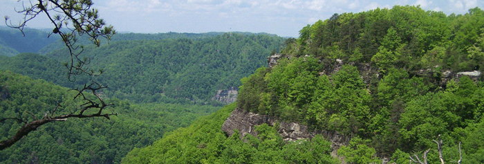
The Breaks is one of the deepest gorges in the eastern United States. The park is located on the northern edge of the Pine Mountain Thrust Block. From numerous overlooks you can view the long crest of Pine Mountain southward from the park. Pine Mountain sits on a block of the earth’s crust that was pushed up and over underlying crust approximately 4 miles in the Breaks area. The gorge owes much of its rugged scenery to this ancient tectonic history. A large tear fault called the Russell Fork Fault occurs just southwest of the park. Scenic trails along the cliff line provide views of Russell Fork and exceptional exposures of Pennsylvanian-age, conglomeratic sandstones. The park has many good examples of fracture influences on weathering and erosion.
Cumberland Falls State Resort Park

Cumberland Falls is one of the largest waterfalls in the eastern United States. Scenic trails above and below the falls provide exceptional exposures of Pennsylvanian-age conglomeratic sandstones in cliffs along the Cumberland River. A thin coal bed is exposed along one trail and near the entrance to the parking lot for the falls. On evenings when the full moon is visible, a “moonbow” can sometimes be seen in the mist from the falls when the moonlight is at the right angle in the sky.
Falls of the Ohio State Park
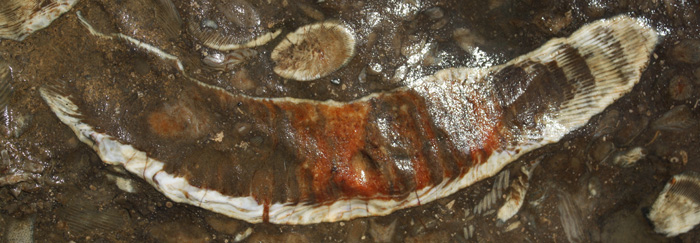
Falls of the Ohio is an Indiana state park and National Wildlife Conservation Area. It is one of the most famous fossil sites in North America. Thousands of fossils of marine organisms from the Devonian Period are exposed in bedrock along the river at low water levels during the summer. A wonderful interpretive center has exhibits on the geology, paleontology, and natural history of the area, including a diorama of the Silurian and Devonian seafloor at the falls when the area was a shallow sea, and a diorama of a Devonian coastal swamp. A mastodon skeleton greets visitors to the center. A fossil festival is held each fall.
- https://www.fallsoftheohio.org/
- McGrain’s (1985) Geologic Story of Kentucky, including a section about Falls
- Greb and other’s (1995) Fossil beds of the Falls of the Ohio
Lake Cumberland State Resort Park
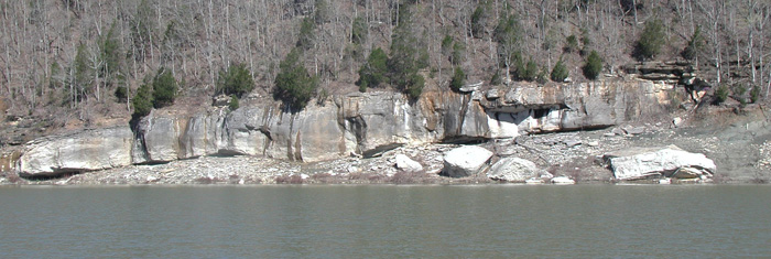
Although there are few geological sites in the park itself, the lake extends well beyond the park boundaries and outcrops are common. The Mississippian-age Fort Payne Formation along the lake contains famous reef-like mounds. More important to the nongeologist are geodes and fossils (especially crinoid columnals, or so called “beads”), which are common along the lakeshore.
McConnell Springs

The park has a short trail that highlights the karst geology of central Kentucky. Signs and trail guides explain various karst features and the importance of the spring to the early history of the city. Along the trail, water rises to the surface in spring, sinks below the surface, comes back to the surface, and then, after flowing through a small creek, disappears back into the ground.
Natural Bridge State Resort Park

Natural Bridge is the longest natural arch in the state. A trail from the lodge leads up to the bridge, or you can take a ski lift to the top. Trails to the bridge are lined with rocky cliffs, rock shelters, balancing rocks, and overlooks. There are good exposures of Mississippian-age limestones and Pennsylvanian-age conglomeratic sandstones along the trails. Many good examples of fracture influences on weathering and erosion can also be seen along trails.
- https://parks.ky.gov/parks/resortparks/natural-bridge/
- Did you know that Pine Mountain has moved?
- McGrain’s (1985) Geologic Story of Kentucky, including a section about bridge
- A Geologic Field Guide in the Park Area by Ettensohn and others (2010)
- A Geologic Field Guide in the Park Area by Greb and others (2005)
- McFarlan's (1954) Geology of the Natural Bridge state park area
- A Virtual Geology Trip to Natural Bridge
Raven Run Nature Sanctuary

Views of the Kentucky River Palisades and a small stream that cuts a narrow gorge down to the Kentucky River. Outcrops along the creeks consist of Ordovician-age limestones. Very good examples of fracture controls on erosion are visible along the creeks. The Nature Center has exhibits, which include a display of characteristic fossils from the region.
Related Topics:
- Geology Research Centers and Universities with Geology Majors
- Museums with Geology and Earth Science Exhibits
- Organizations and Clubs have Earth-Science Meetings and Sponsor Field Trips

